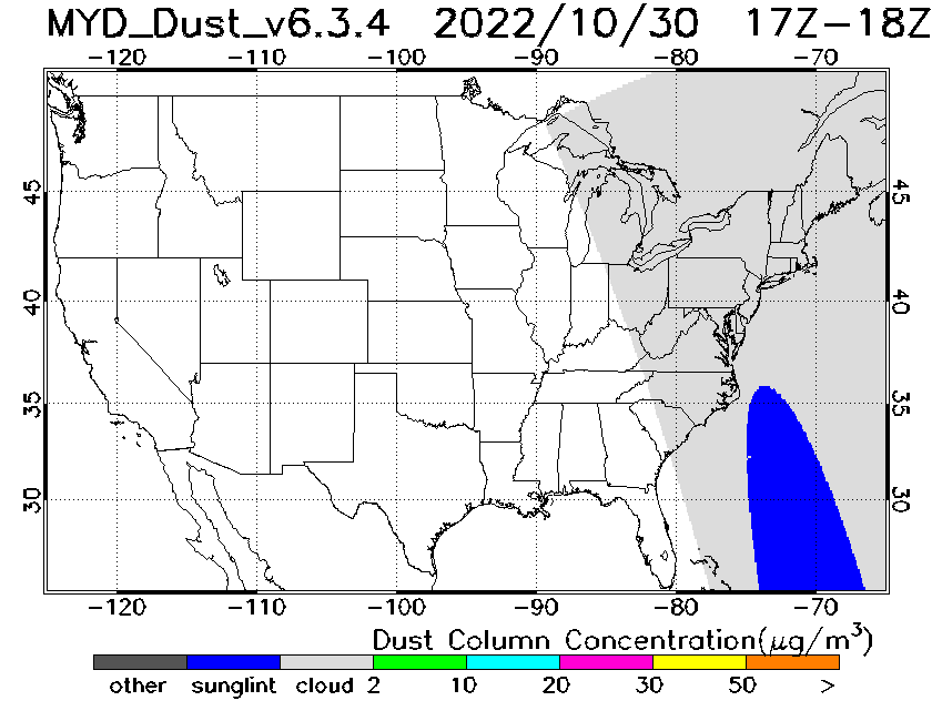
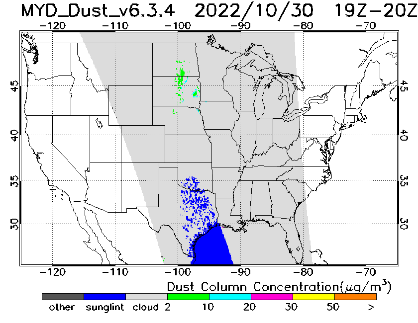
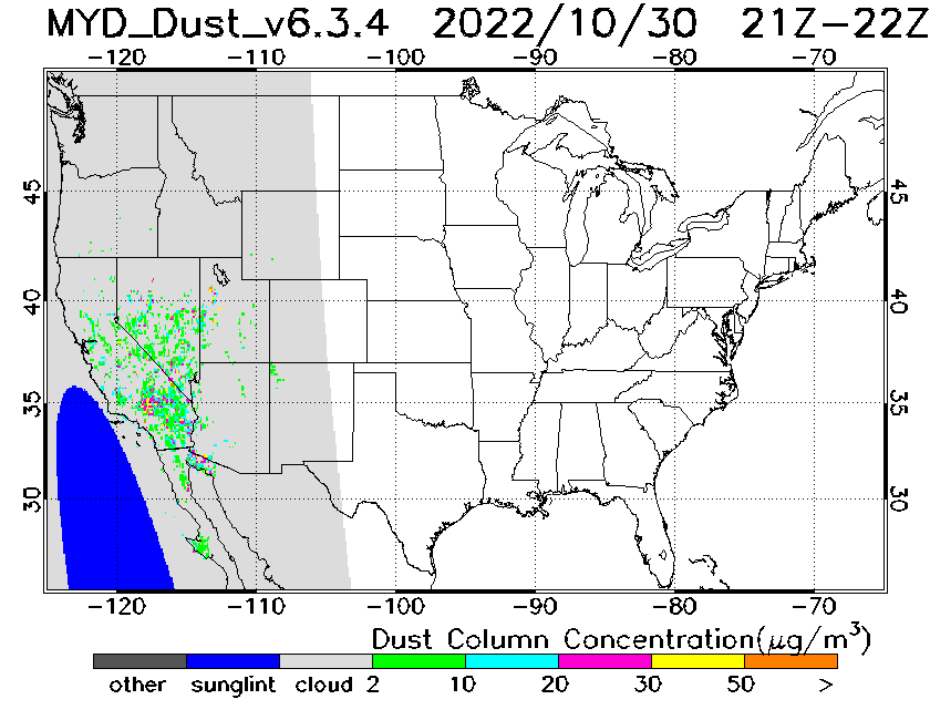
MODIS Dust Mask Algorithm Product
The MODIS Deep Blue Dust Index (DBDI) V6.3.4 algorithm runs on each
MODIS granule covering the US CONUS. A 1-km resolution dust flag product is first created. The MODIS 1-km dust flag product is then gridded (0.1° x 0.1°) extending from 65°W to 125°W and 25°N to 50°N. This domain is the same as the operational Hybrid Single Particle Lagrangian Integrated Trajectory (HYSPLIT) model that provides operational dust forecasts. The gridded dust flag is then combined with operational MODIS Level_2 regular and Deep-Blue Aerosol Optical Depth (AOD) product to generate a dust aerosol optical depth and dust mass concentration products. The last step is to create hourly dust aerosol product (AOD and mass column concentration) in the HYSPLIT dust modeling domain. The final output date files are in General Regularly-distributed Information in Binary form (GRIB) format with GRIB I header. The output files are also available in Network Common Data Form (NetCDF).
Animated Image Loop
 Indicates a link outside the U.S. Government.