
 |
 |
|
|
The FIMMA product is an automated algorithm to detect fires from Advanced Very High Resolution Radiometer (AVHRR) data from the NOAA polar-orbiting satellites. The FIMMA product was originally developed by Dr. Ivan Csiszar while he was a member of the Cooperative Institute for Research in the Atmosphere, working at the NOAA/NESDIS Office of Research and Applications (ORA) in Camp Springs, Maryland. The latest version of FIMMA uses geo-corrected High Resolution Picture Transmission (HRPT) AVHRR data over the US (including Alaska and Hawaii) received from the NOAA/NESDIS CoastWatch group and uses the SeaSpace Terascan software to correct for known AVHRR navigation errors.
The FIMMA product is running in Demonstration mode within the Satellite Services Division (SSD). Products are currently being made from available NOAA-15 (~7:30 am and pm, local time), NOAA-16 (~1:30 am, local time) and NOAA-17 (~10:30 am and pm, local time) passes, which have 3.7 micron measurements. The orbital data are available near-realtime, typically 3-6 hours after satellite overpass
Users should note:
The original FIMMA algorithm was based on the scheme described in the paper "Satellite-based Detection of Canadian Boreal Fires: Development and Application of the Algorithm" by Dr. Zhanqing Li, (et al) of the Univ. of Maryland, modified with the addition of a slightly simplier method for nighttime fire detection. This was basically a threshold algorithm, with additional checks added in attempt to minimize false detects. Recently, the algorithm was rewritten as a contextual algorithm, which considers the characteristics of surrounding pixels before deciding if a hot pixel is likely to be a real fire. This was done considering methods used by several Fire groups, described in the another of Dr Li's papers, "A Review of AVHRR-based Active Fire Detection Algorithms: Principles, Limitations, and Recommendations", and Dr. Louis Giglio's (et al) paper "Evaluation of Global Fire Detection Algorithms using Simulated AVHRR Infrared Data" (Int. J. Remote Sensing, 1999, Vol 20, No 10, 1947-1985). It uses AVHRR channels 2 (.9 micron), 3b (3.7 micron), 4 (10.8 micron) and 5 (12 micron). Additional checks have been added to screen for noicy HRPT data.
The most recent FIMMA detects, as well as the other layers that make up the HMS Fire and Smoke Product, can best be viewed through our SSD Fire Web-GIS page.
Download most current fire files (available in ASCII, GIS and graphic formats).
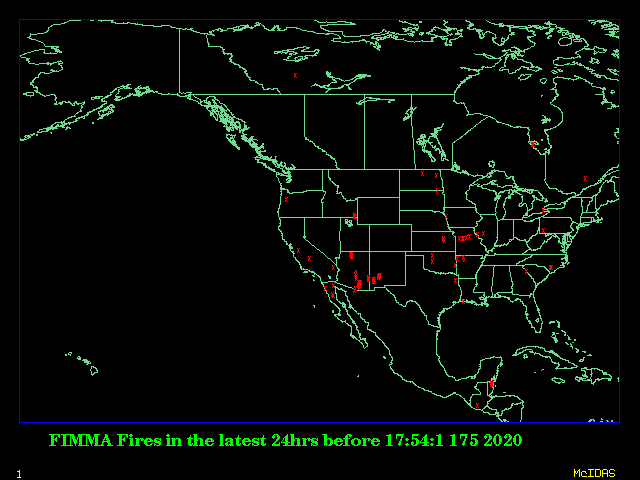
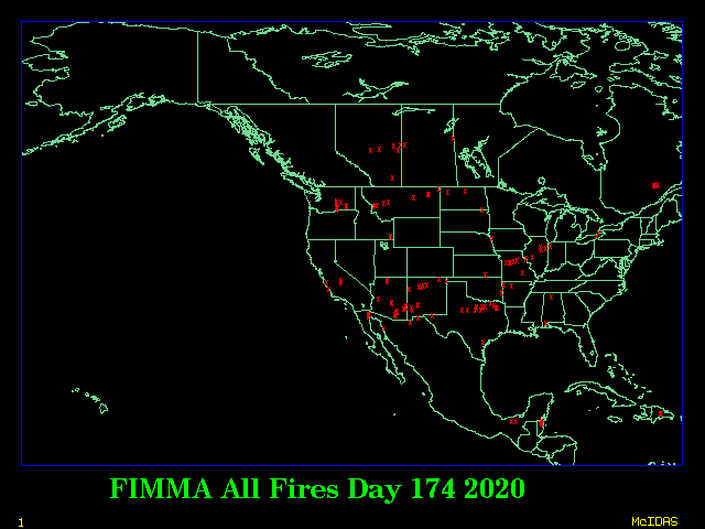
Here are plots of the last 24 hours of FIMMA detects, and yesterday's daily composite FIMMA fire product. The red "X's" are hot spots detected by this automated algorithm.
Contact Address: SSDFireTeam@noaa.gov
|
Contact Information: |
||
|
You are Here: http://www.ssd.noaa.gov/PS/FIRE/Layers/FIMMA/fimma.html
|